
What TownStakes does
Everything below works in the app today.
Screens are from the real app, running a test campaign in St. Clair. Hosts' names, house numbers and chat messages are made up.
Drop it, check it, done
GPS or tap the map
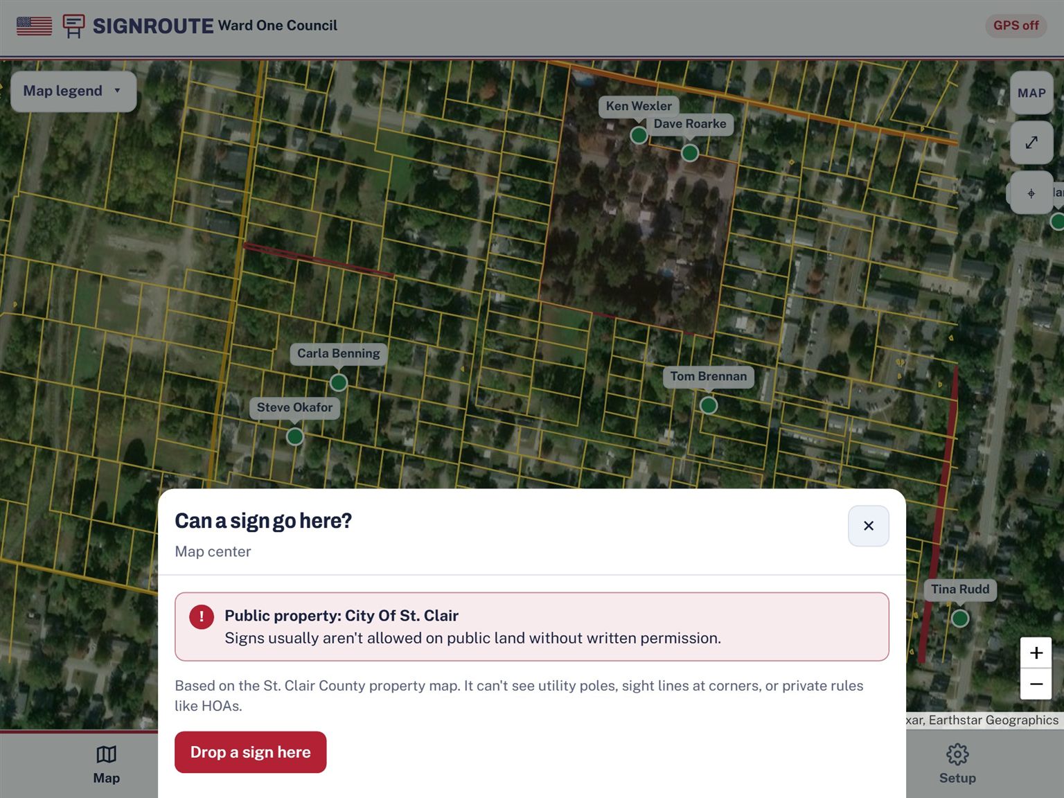
Standing in the yard? One tap drops the sign at your phone's location. Planning from the kitchen table, or on a Wi-Fi-only iPad with no GPS? Tap the spot on the map instead.
Photo, notes and host name
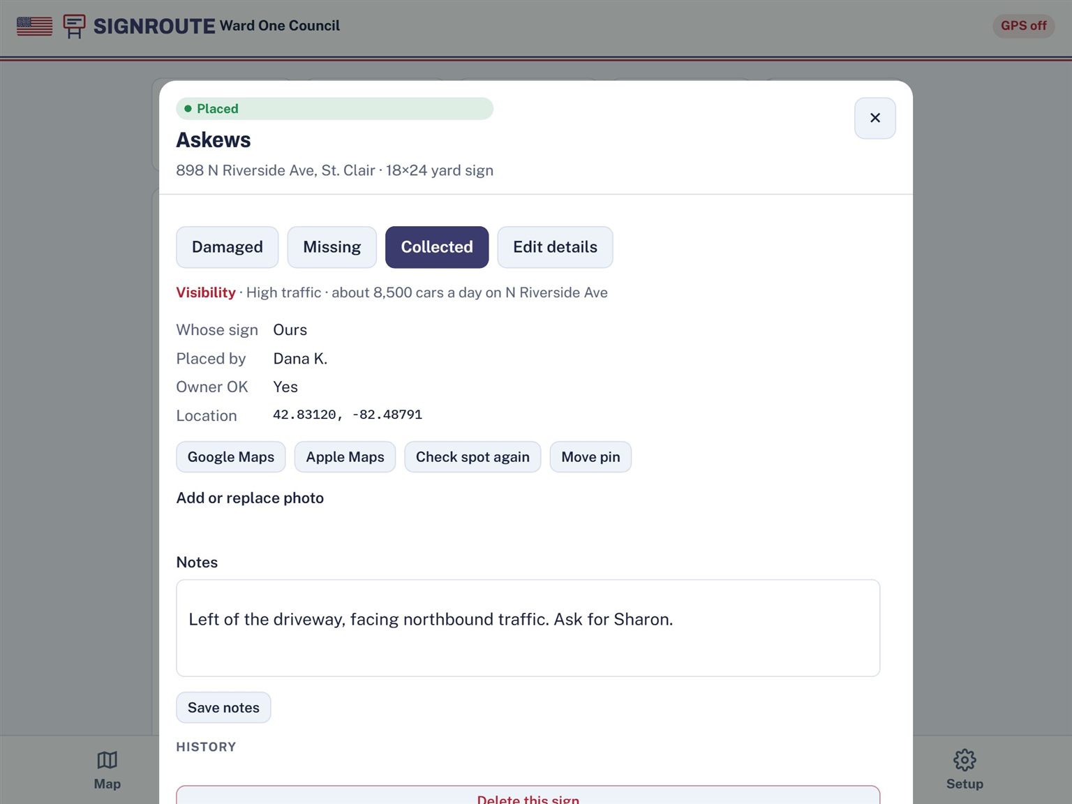
Snap a photo, add notes like "left of the driveway," and record whose house it is, such as "Askews house." When you zoom out, the map shows host names, so your team talks about signs the way they already do.
Property check before you place
TownStakes looks up the parcel and warns you if the spot is city or county land, a park, a school, or the road right-of-way. Uses St. Clair County, Michigan parcel data today; more counties are coming.
Property lines and satellite view
Turn on parcel lines over a satellite photo to see exactly where one yard ends and the next begins. Public land is shaded red.
Import a spreadsheet
Already have a list of sign requests? Bring it in from Excel, Google Sheets or a CSV file. TownStakes matches each address to its spot on the map.
See the race the way drivers see it
Opponent signs
Log opponents' signs as diamonds, each opponent in their own color. Filter the map to one opponent to see where they're strong.
Real traffic counts
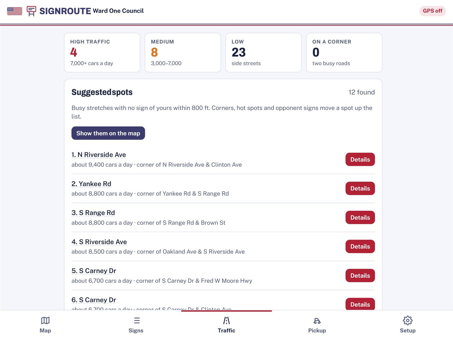
Michigan DOT daily car counts show right on the map. Every sign you place gets a High, Medium or Low traffic rating.
Suggested spots
TownStakes marks busy stretches with no sign of yours within 800 feet. Corners, hot spots and opponent signs move a spot up the list.
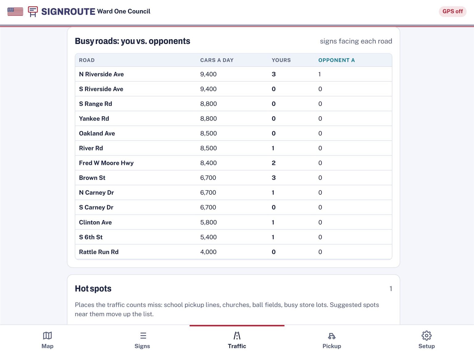
Busy roads: you vs. them
A table of the busiest roads in your area, with your sign count next to each opponent's.
Hot spots
Mark the places traffic counts miss: school pickup lines, churches, ball fields and busy store lots.
Voter list
Import the Qualified Voter File from your clerk, or have us pull it for you: we'll get the file for your area and load it into your campaign. Tap a house to see who lives there, who votes regularly, and the ward and precinct. The list is private to your campaign, and volunteers see names only.
Get every sign back before the deadline
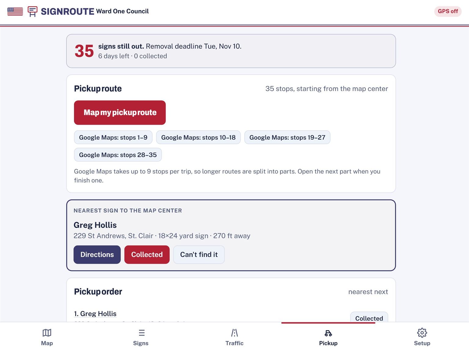
Removal-deadline countdown
Set the date your signs must come down and TownStakes counts down the days so nobody forgets.
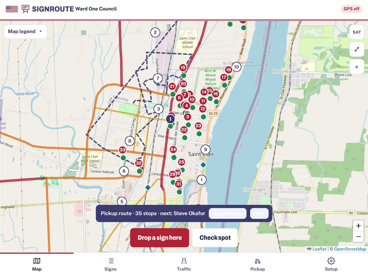
A mapped pickup route
The signs still standing are put in order on the map so a volunteer can drive one loop instead of zigzagging across town.
Google Maps directions
Google Maps takes up to 9 stops per trip, so TownStakes splits a long route into parts. Open the next part when you finish one.
One map for the whole campaign
Shared campaign accounts
Everyone on your team works from the same map. Send an invite link by text or email and choose what role the person joins as.
Sign in with an email code
No passwords to forget. Enter your email, get a code, type it in.
Roles that fit a campaign
Owner runs the campaign. Managers edit everything, import lists and invite people. Volunteers drop, pick up and report signs. View only can see the map and lists but not change them.
Assign signs to volunteers
Owners and managers hand out the work: planned spots to place, or signs that are out to pick up. Assign one sign or many at once, with a due date if you want one.
"Your list" for every volunteer
Volunteers see their own list with due dates and a Map my route button. Their assigned signs have a gold ring on the map. Only owners and managers can reassign work.
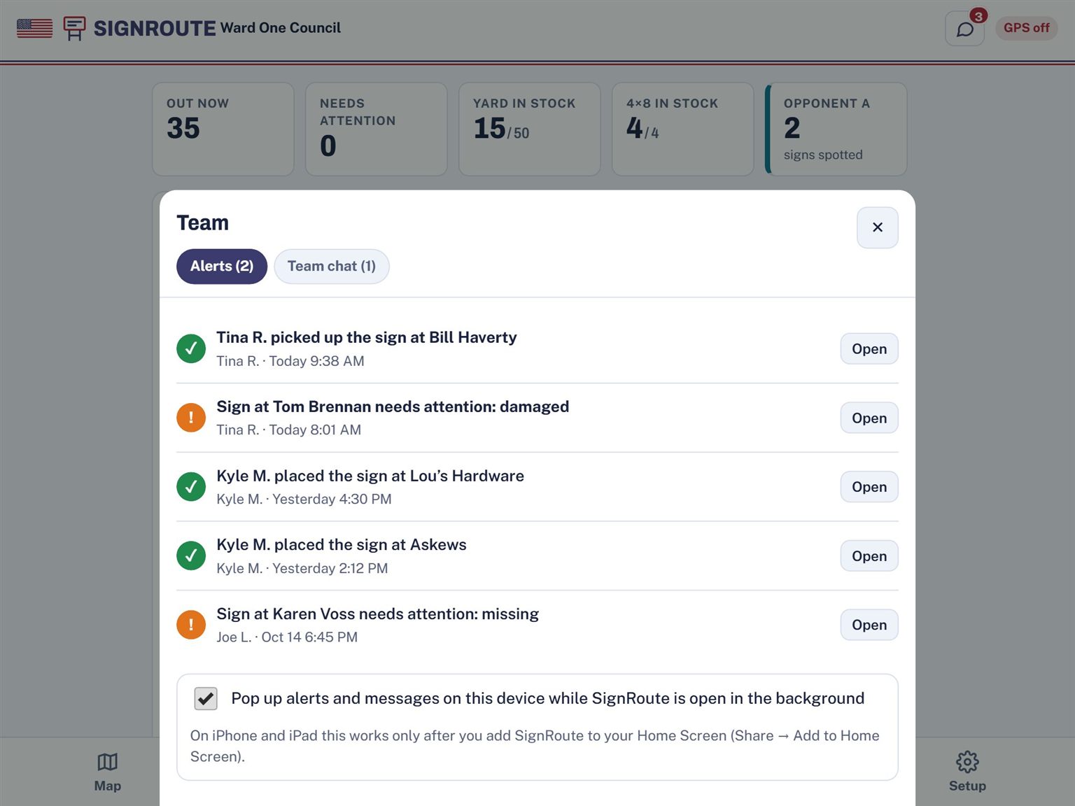
Alerts
A chat bubble in the top bar shows a red count. Volunteers get an alert when a sign is assigned to them. Managers get one when a sign is reported damaged or missing, and when a volunteer finishes a job: "Kyle placed the sign at Rood's." Each person sees only their own alerts.
Alerts show up live while TownStakes is open. On devices that allow it, they can also pop up while it runs in the background (on iPad and iPhone, after you add TownStakes to your home screen). They don't arrive when the app is fully closed.
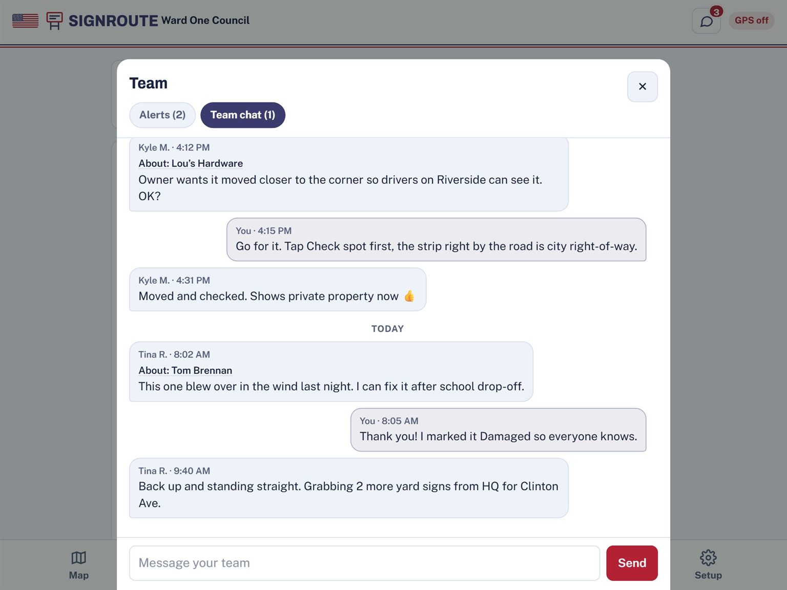
Team chat
One shared conversation for your campaign, private to your team. Every sign has a Message team button that attaches the sign to your message, so nobody asks "which one?"
Live sync
When a volunteer drops a sign across town, it shows up on your map right away.
Works with no signal
Out on a back road with no bars? Keep going. Your signs are saved on the device and sync when you're back in range.
Try it on your own street
Start free, drop a sign in front of your house, and see the property check and traffic rating for yourself.