
It checks the property first
Before a volunteer places a sign, TownStakes looks up the parcel. If it's city or county land, a park, a school or the road right-of-way, you get a warning on the spot, not a call from the clerk.
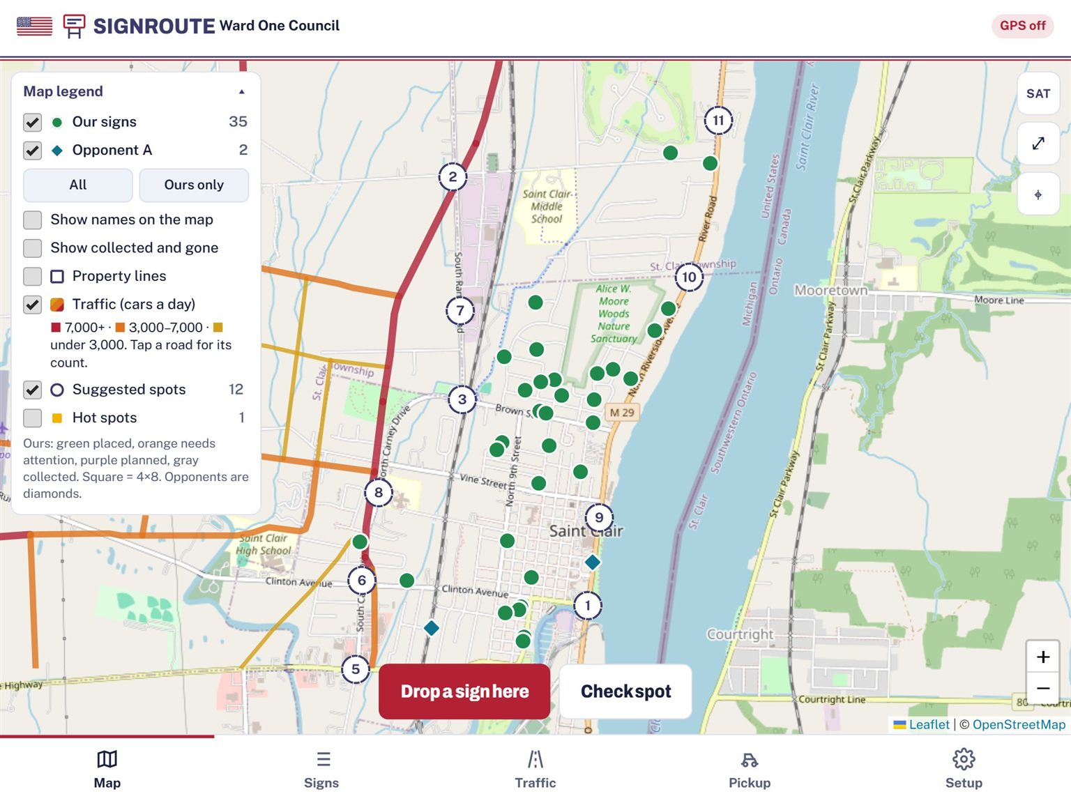
TownStakes puts every campaign yard sign on one shared map. It checks the property before you push a stake in, shows how many cars pass each sign, and turns pickup day into a route.
Start free with 20 signs. Upgrade when you're ready for the whole campaign. Works on iPad, phone and computer, for any candidate and any party.
Before a volunteer places a sign, TownStakes looks up the parcel. If it's city or county land, a park, a school or the road right-of-way, you get a warning on the spot, not a call from the clerk.
Real Michigan DOT daily traffic counts sit right on the map. Every sign gets a High, Medium or Low rating, and TownStakes points out busy stretches where you don't have a sign yet.
Import your clerk's Qualified Voter File, or let us help you request it and load it. Then tap any house to see who lives there, who votes regularly, and the ward and precinct. The list stays private to your campaign.
Every picture below is TownStakes running a test campaign in St. Clair, Michigan. We changed the hosts' names and house numbers to protect their privacy, and the chat messages are examples.
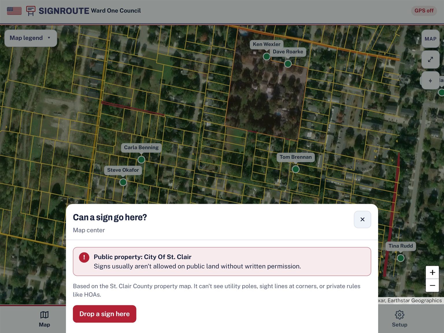
Line the map up on a spot and tap Check spot. TownStakes looks up the St. Clair County parcel and tells you who owns it. Here it's the City of St. Clair, so it warns you before anyone digs a hole.
Public lots are shaded red on the property-line layer, so you can spot them from across the street.
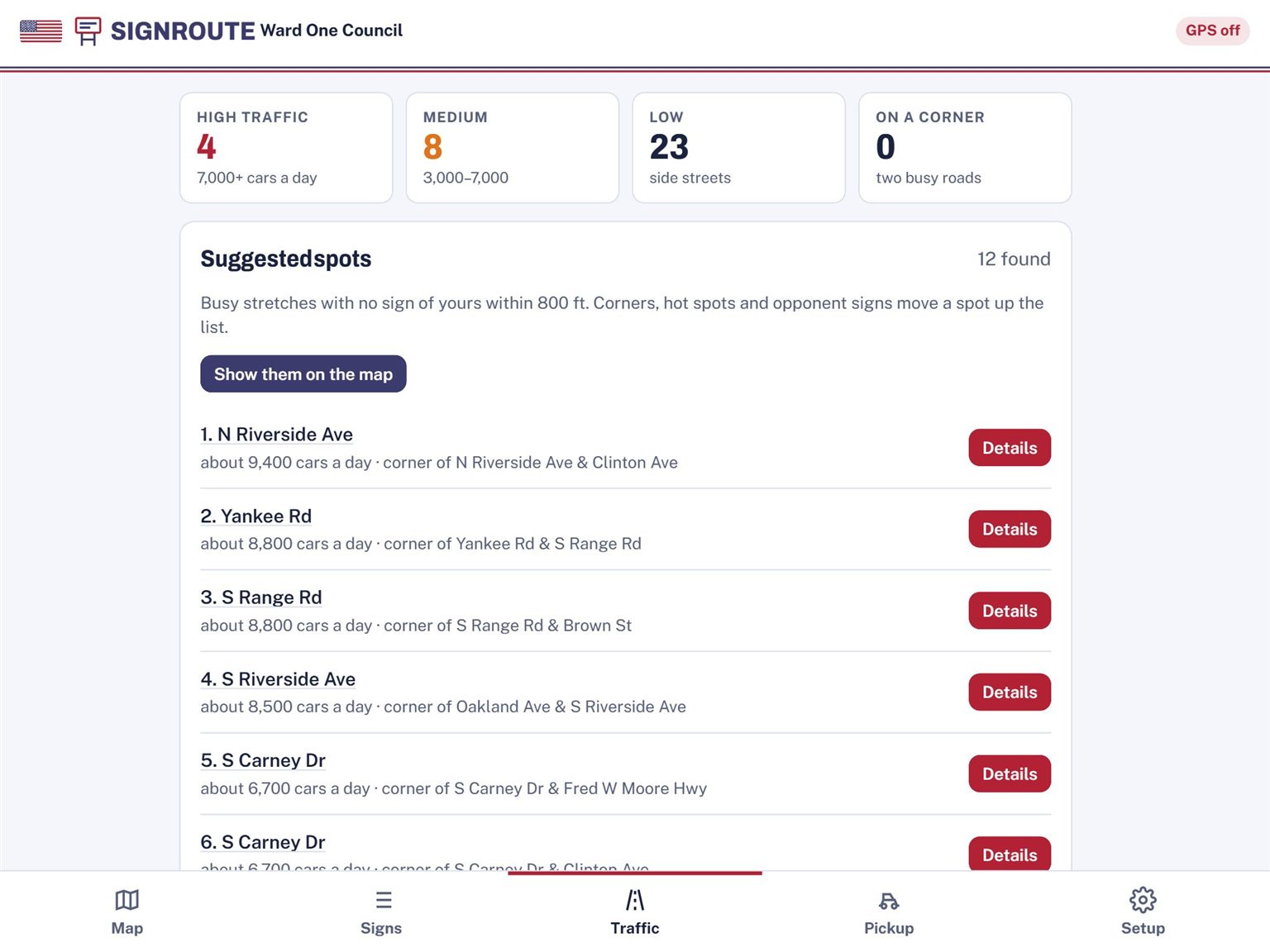
TownStakes uses state traffic counts to rate every sign. In this campaign, 4 signs face high-traffic roads and 23 sit on side streets.
It then lists the busiest stretches with no sign of yours within 800 feet, like N Riverside Ave at about 9,400 cars a day. Tap Details and go get a yard there.
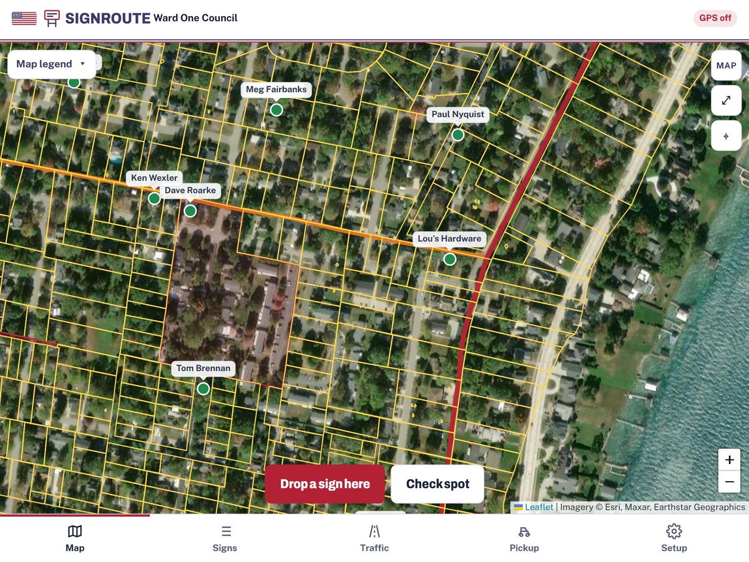
Each sign carries the host's name, so the map reads like your volunteers talk: "the one at Lou's Hardware." Turn on the satellite photo and property lines to see exactly whose lawn is whose.
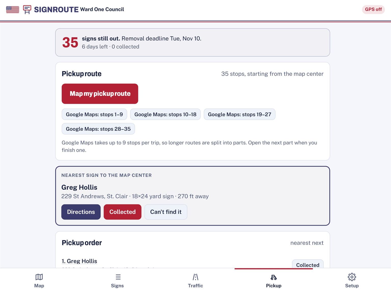
After the election, the Pickup tab counts down to your removal deadline and puts every sign still standing in driving order.
Google Maps takes up to 9 stops per trip, so TownStakes splits the route into ready-made parts. Tap Collected at each stop and the count goes down.
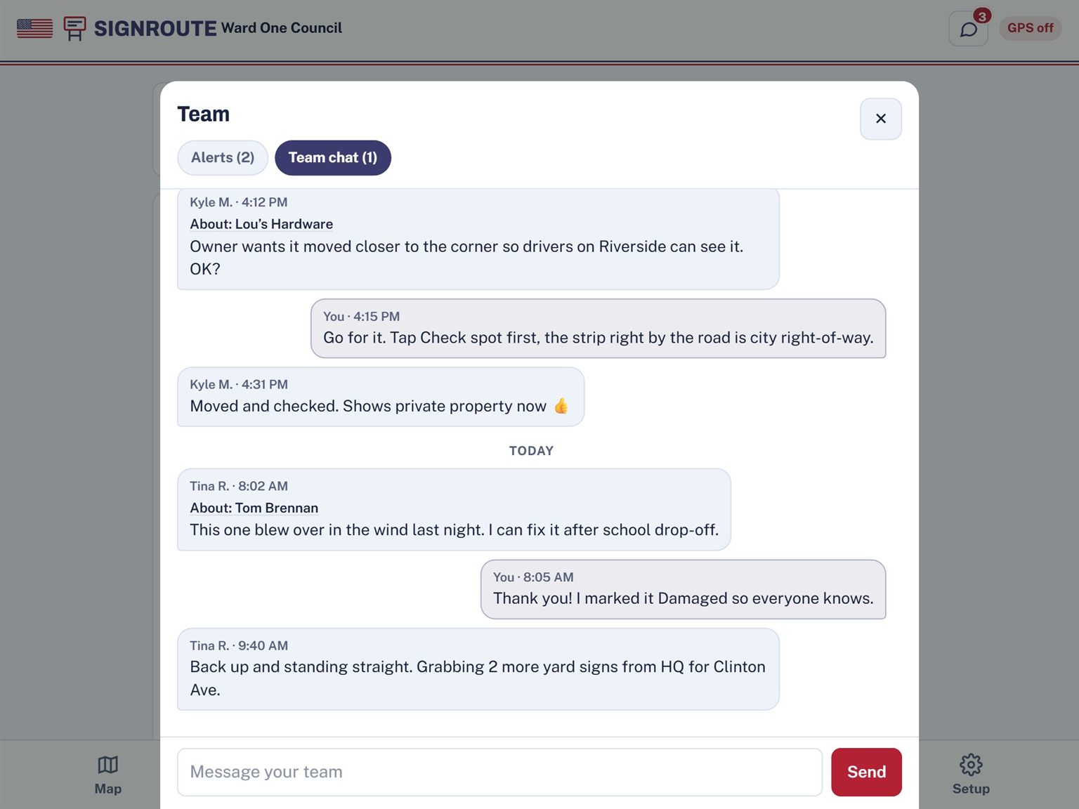
Tap Message team on any sign and the sign rides along with your message. Here Kyle checks before moving the sign at Lou's Hardware, and Tina reports one that blew over.
Managers get an alert when a volunteer finishes a job or reports a sign damaged or missing. Volunteers get one when a sign is assigned to them. The chat stays private to your campaign.
Sign in with a code sent to your email. Name your campaign, add your opponents and pick their colors.
Text or email volunteers an invite link and pick their role. Import your sign request spreadsheet and your clerk's voter file. We can help you request and load the voter file if you'd like.
Assign spots to volunteers and they work from their own list. You watch the map fill in, fill the busy gaps, and hand out pickup routes after the election.
You can place up to 20 signs, add photos and notes, check whether a spot is public land, and use the map offline. Traffic data, volunteer assignments, team chat and pickup routes are on the paid plans. See pricing.
No. You pay once per election, and your plan lasts through sign pickup.
No. TownStakes runs in the web browser on iPad, phone or computer. On an iPad or phone you can add it to your home screen so it opens like an app.
Today it uses St. Clair County, Michigan parcel data. More counties are on the way. Traffic counts cover roads across Michigan that the state DOT measures.
Keep working. Signs you place are saved on the device and sync to the rest of your team as soon as you have a connection again. Wi-Fi-only iPads can't get GPS out in the field, so tap the map to place the sign instead.
Alerts show up live while TownStakes is open, with a red count on the chat bubble. On devices that allow it, they can also pop up while the app runs in the background. On iPad and iPhone that works after you add TownStakes to your home screen. Alerts don't arrive when the app is fully closed.
Only your campaign. Owners and managers see the full details. Volunteers see names only, so they know who to ask for at the door.
No. TownStakes is nonpartisan and built for any candidate in any race, from school board and city council to township and county offices.
Start free with 20 signs. Upgrade when you're ready for the whole campaign: plans start at $39, paid once per election.